Barnet Marine Park


Barnet Marine Park
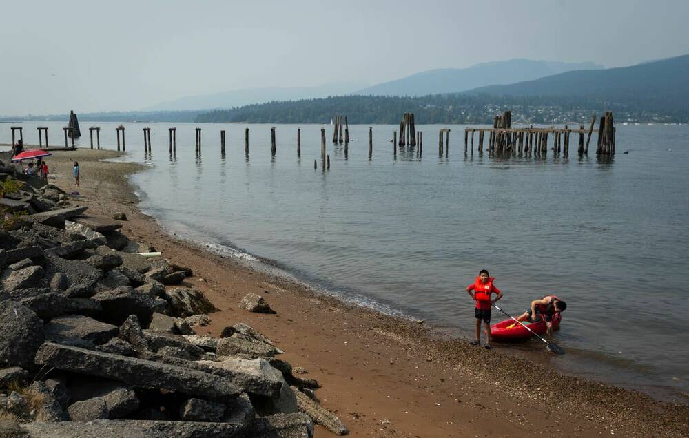
Barnet Marine Park stretches along the eastern edge of Burrard Inlet where Burnaby meets the water. The park occupies a wide strip of shoreline backed by forested slopes. As a result, it creates an open coastal landscape that contrasts with the dense city neighbourhoods nearby. Driftwood logs line the beach and the view looks west across the inlet toward the North Shore mountains.
The shoreline is the defining feature here. Instead of sandy beaches, the coast is made up of pebbles, driftwood, and tidal rock shelves that shift subtly with the tide. At low tide, sections of the beach widen to reveal additional shoreline and tidal pools. When the water rises again, waves lap directly against the logs and rocks that form the natural edge of the park.
A walking and cycling path runs the length of the waterfront, connecting the open beach areas with grassy fields and small forest sections behind the shore. The route is part of the larger Trans Canada Trail corridor. Moreover, many visitors follow the path along the water while watching boats move through Burrard Inlet.
The park’s position at the mouth of the inlet gives it an expansive feel. Tankers and ferries occasionally pass in the distance while the mountains of the North Shore rise across the water. Despite its proximity to the city and nearby rail lines, the wide shoreline provides space to spread out and take in the coastal landscape.
Barnet Marine Park is also known as one of the region’s better sunset viewpoints. As the sun lowers over the inlet, the light reflects across the water toward the mountains. Because of this, the light often draws visitors to the beach during the evening hours.
The combination of shoreline, open sky, and mountain views gives the park a different character from Vancouver’s forest trails. Here, the connection to nature comes through the ocean and horizon rather than the canopy overhead.